California John Muir Trail Southbound to Mt. Whitney Trekking Tour
An Exclusive Wilderness Adventure with Summit Challenge
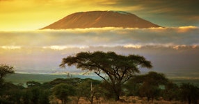
Embark on this once-in-a-lifetime one-of-a-kind adventure and trek the legendary John Muir Trail, rated one of the top 10 trails on the planet! This incredible Mountain Travel Sobek exclusive expedition will take you through the awe-inspiring and picturesque high Sierra Nevada, covering 135.5 miles of the southern half of the John Muir Trail. Designed for up to 10 adventurers, and fully pack stock-supported, you'll be ensured of a personalized experience with three expert guides, two mule wranglers, and a support team that makes fresh food drops along the way. With only a day pack, you'll traverse mountain passes, camp beside sparkling lakes, and marvel at the stunning alpine meadows. To top it off, you have the opportunity to climb Mount Whitney, the highest peak in the continental United States, and experience the thrill of reaching its summit. Don't miss out on the best John Muir Trail hiking adventure. Join us now!
Embark on this once-in-a-lifetime one-of-a-kind adventure and trek the legendary John Muir Trail, rated one of the top 10 trails on the planet! This incredible Mountain Travel Sobek exclusive expedition will take you through the awe-inspiring and picturesque high Sierra Nevada, covering 135.5 miles of the southern half of the John Muir Trail. Designed for up to 10 adventurers, and fully pack stock-supported, you'll be ensured of a personalized experience with three expert guides, two mule wranglers, and a support team that makes fresh food drops along the way. With only a day pack, you'll traverse mountain passes, camp beside sparkling lakes, and marvel at the stunning alpine meadows. To top it off, you have the opportunity to climb Mount Whitney, the highest peak in the continental United States, and experience the thrill of reaching its summit. Don't miss out on the best John Muir Trail hiking adventure. Join us now!
Hike through the Sierra Nevada most scenic wilderness trails on this exclusive MT Sobek expedition
[Description] => Hike through the Sierra Nevada most scenic wilderness trails on this exclusive MT Sobek expedition
[Image] =>
[VideoLink] =>
)
[1] => Array
(
[DisplayOrder] => 2
[HighlightText] =>
Enjoy views of stunning mountain peaks and wildflower-dotted meadows - California's High Sierra at its finest
[Description] => Enjoy views of stunning mountain peaks and wildflower-dotted meadows -- California's High Sierra at its finest
[Image] =>
[VideoLink] =>
)
[2] => Array
(
[DisplayOrder] => 3
[HighlightText] =>
Finish in style by summiting Mount Whitney, the continental United States' highest peak, at 14,505 feet
Arrive in Fresno, California, to check in at the Fairfield Inn & Suites Fresno Yosemite Airport, near the Fresno air terminal, by 4pm. At 6pm, join the guides for an orientation and final gear check, along with a welcome dinner near the hotel.
Accommodation: Fairfield Inn & Suites Fresno Yosemite Airport
Meals: Dinner
Follow the South Fork of the San Joaquin River
Day 2
Meet at 7am after breakfast, then drive about three hours to Florence Lake where you meet the horse-packer and mules to offload the gear. Then begin the first leg of the trip, which starts with a ferry ride across Florence Lake (7,325'). Today's mild acclimatizing hike goes 6.3 miles through lush meadows following the South Fork of the San Joaquin River. There is a 500-foot elevation gain along the way to the camp on the San Joaquin River.
Activity: 3-4 hours/6.3-8 miles hiking with 1,500' elevation gain and 1,050' elevation loss
Transportation: 3-hour private van transfer & ferry ride
Meals: Breakfast, Lunch, Dinner
Hike from Piute Creek to Goddard Canyon
Day 3
Continue the acclimatization process with another "easy" day on the trail. From Piute Creek, hike 6.2 miles of relatively flat terrain to the junction of the South Fork of the San Joaquin River and Goddard Canyon. Get a good night's sleep here in preparation for the ascent into the famous Evolution Canyon.
Activity: 3-4 hours/6.4 miles with 1,437' elevation gain and 775' elevation loss
Meals: Breakfast, Lunch, Dinner
Reach Evolution Lake
Day 4
Today's hike is approximately seven miles with an elevation gain of 2,400 feet into what some call the most spectacular portion of the trail. After a climb out of the river canyon, enter Evolution and then McClure Meadows. In this section the trail parallels Evolution Creek, which teems with golden trout. Camp at the spectacular Evolution Lake (10,852'), a gorgeous deep-blue lake that's one of the prettiest spots in the Sierra.
Activity: 4-5 hours/7.81 miles with 2,820' elevation gain and 425' elevation loss
Meals: Breakfast, Lunch, Dinner
Descend into LeConte Canyon
Day 5
From your camp at the very edge of the tree line, climb over Muir Pass (11,955'), taking a rest at the 75-year-old stone hut at the crest of the pass. Then descend on rocky terrain into LeConte Canyon (8,735'), with its impressive vertical walls of granite. Here, meet the first food drop on the trip.
Activity: 6-7 hours/12.89 miles hiking to 11,955' with 1,815' elevation gain and 3,812' elevation loss
Meals: Breakfast, Lunch, Dinner
Head for Mather Pass & Camp at Palisades Lakes
Day 6
On the way out of LeConte canyon, pass through Grouse Meadow and follow the Middle Fork of the Kings River. At the junction with Palisades Creek, turn east and begin the climb toward Mather Pass (12,100'). After tackling the Golden Staircase, camp short of the pass at Palisades Lakes (10,600') after approximately 9.5 miles.
Activity: 5-6 hours/10.85 miles hiking to 12,100' with 3,129' elevation gain and 1,392' elevation loss
Meals: Breakfast, Lunch, Dinner
Climb Mather Pass & Reach South Fork of the Kings River
Day 7
From Palisades Lakes tackle Mather Pass (12,100') and then descend through the Upper Basin, losing some 2,000 feet before reaching the South Fork of the Kings River. Stay on the Kings River tonight, enjoying the sounds of the gurgling river.
Activity: 5-6 hours/8.87 miles hiking to 12,100' with 1,746' elevation gain and 2,311' elevation loss
Meals: Breakfast, Lunch, Dinner
Tackle Pinchot Pass & Descend to Crater Mountain Plateau
Day 8
Today hike up to the Marjorie Lakes area, a glacier-scoured basin of stark beauty. Enjoy the dazzling scenery of pristine mountain lakes before tackling Pinchot Pass (12,130'). Descend to the Crater Mountain plateau for the night.
Activity: 4 hours/7.22 miles hiking to 12,130' with 2,278' elevation gain and 1,732' elevation loss
Meals: Breakfast, Lunch, Dinner
Hike Up to Arrowhead Lake
Day 9
Today head down into the Woods Creek basin (8,500'), across the "Golden Gate of the Sierra" suspension bridge, and then back up to Arrowhead Lake (10,300'), where you camp.
Activity: 5-6 hours/8.49 miles hiking to 10,300' with 2,157' elevation gain and 2,387' elevation loss
Meals: Breakfast, Lunch, Dinner
Ascend Glenn Pass and Hike to Center Basin
Day 10
Continue the journey by passing through the Rae Lakes Basin. Next ascend the rocky switchbacks of Glenn Pass (11,978'), followed by a descent to Vidette Meadow where you meet the second food drop. Continue to Center Basin, hiking amidst the stark beauty of huge precipitous ridges.
Activity: 5-6 hours/8.97 miles hiking to 11,978' with 2,581' elevation gain and 3,009' elevation loss
Meals: Breakfast, Lunch, Dinner
Face Forester Pass, the Highest On the JMT
Day 11
At first light, head up the highest pass on the JMT (as well as the entire Pacific Crest Trail, for that matter) - the Forester Pass at 13,180'. From Forester descend to Tyndall Creek, passing the Diamond Mesa on the way. Make camp below the awesome Mount Whitney Massif.
Activity: 7 hours/11.2 miles hiking to 13,180' with 3,389' elevation gain and 2,367' elevation loss
Meals: Breakfast, Lunch, Dinner
Hike to Wallace Creek
Day 12
Today is a shorter day, featuring a hike that goes 5 miles from Tyndall Creek to Wallace Creek. At this scenic spot, enjoy a lazy afternoon resting in a meadow and playing in the creek.
Activity: 2-3 hours/4.42 miles hiking to 10,405' with 604' elevation gain and 1,144' elevation loss
Meals: Breakfast, Lunch, Dinner
Hike to Mt. Whitney Basecamp
Day 13
Enjoy a contemplative hike up to Crabtree Meadow, nestled at the base of the Eastern Sierra and the perfect basecamp for Mt. Whitney. Fuel up on an early supper before climbing into your sleeping bags after sundown. Relax in preparation for tomorrow's pre-dawn "alpine start" and your Mt. Whitney summit bid.
Activity: 4-5 hours/6.5 miles hiking to 10,975' with 1,952' elevation gain and 859' loss
Meals: Breakfast, Lunch, Dinner
Attempt the Summit of Mount Whitney
Day 14
Today take off early (at 4am) for the "high" point of the entire trip: a walk-up summit attempt of Mount Whitney (14,495'), the highest peak in the contiguous United States. You have worked hard to get on top, and now is the time to enjoy the 360 degree view that the highest peak in the Continental US affords you. The day's hike is 13 miles roundtrip back to Lower Crabtree Meadow.
Activity: 9-10 hours/12.67 miles hiking to 14,495' with 3,621' elevation gain and 4,769' elevation loss
Meals: Breakfast, Lunch, Dinner
Meander Crabtree Meadows to Rock Creek
Day 15
Today is a leisurely day in terms of terrain: lose 2,000 feet in elevation and then gain 1,900 feet (net gain of only 100 feet) as you meander through Crabtree Meadows on the way to the last night's camp at Rock Creek.
Activity: 5 hours/9.23 miles hiking with 1,998' elevation gain and 1,891' elevation loss
Meals: Breakfast, Lunch, Dinner
Pass Golden Trout Wilderness & Rest in Lone Pine
Day 16
The last day on the trail is a long one. Head up from Rock Creek over Cottonwood Pass (11,200'). Have a snack around Chicken Spring Lake on the way out of the Sequoia National Park for the last few miles through the Golden Trout Wilderness. It's 10 miles to the trailhead where picnic lunch awaits, as does the shuttle for a short drive to the nearby Eastern Sierra town of Lone Pine, California, home for the night. After a well-deserved shower, rendezvous for a final dinner.
Accommodation: Best Western Frontier Motel
Activity: 5-6 hours/10.53 miles hiking to 11,200' with 1,722' elevation gain and 2,239' elevation loss
Transportation: 20-minute shuttle transfer
Meals: Breakfast, Lunch, Dinner
Travel Home
Day 17
After a good night's rest and breakfast on your own, depart early with the private shuttle back around the Sierra. The drive back to the starting point, Fresno airport, takes 5 to 6 hours. To build in any unforeseen road delays, plan your flights for the early afternoon, starting after 3pm.
MT Sobek has been exploring US National Parks for more than 50 years, placing a strong emphasis on responsible travel practices that support local communities and protect the natural environment.
This award-winning 17-day southbound trek to Mt. Whitney is fully aided with the support of a professional packer and mules that transport gear and move camp. This allows you to fully focus on the epic scenery and enjoy the challenge of the adventure.
Trek with our expert MT Sobek guides, who have in-depth knowledge of this remote and expansive mountain region. They'll also entertain with in-depth knowledge of local flora, fauna and legends about the great explorers who first blazed these trails.
Dreaming of an adventure designed exclusively for you? With insider access and decades of experience, our travel experts create custom tailored adventures that are perfect for families, couples, and large groups. MT Sobek's custom adventures are designed to our exacting standards and led by our award-winning adventure guides.
When to start planning? Earlier is always better when designing a custom trip. More time allows for better availability of preferred accommodations, guides and your desired activities. Ideally, start the conversation with us at least 6 months before you want to travel. If you are looking for a custom trip that departs within three months, chances are greatly diminished in securing requested accommodations and the best guides.
*Custom trips require a 25% non-refundable deposit once an itinerary is agreed upon.
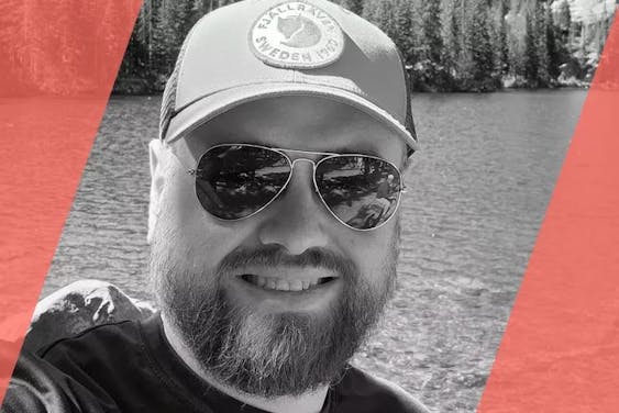
The best people to immerse you in a destination are the ones who live there, which is why we feature local Adventure Guides on our trips. Here are a few that you might meet on this adventure.
Fred A.
Fred enjoyed his first backpacking trip in college, walking 20+ miles in inappropriate footwear and spending a few cold nights in front of the fire without a sleeping bag. He caught the travel bug from there and was soon plotting and executing adventures in California's endless wild places. In addition to being an adventure guide, Fred is also an EMT with a certification in wilderness medicine. He's hiked and climbed thousands of miles around the Sierra including a solo 200+ mile hike of the Sierra High Route. Join Fred on MT Sobek's hiking adventures in California.
Alex K.
Alex grew up in Concord, New Hampshire exploring the mountains of New England. It was here that his spirit and passion for adventure began. Alex's love for shared wilderness experiences has culminated in a degree in Outdoor Education and certifications from the American Mountain Guiding Association (AMGA). Moving to California was the culmination of a dream come true, where he is able to combine his passion for climbing with a career in guiding. He has a tremendous amount of experience in the backcountry and great leadership qualities.
Arrive in Fresno, California, to check in at the Fairfield Inn & Suites Fresno Yosemite Airport, near the Fresno air terminal, by 4pm. At 6pm, join the guides for an orientation and final gear check, along with a welcome dinner near the hotel.
[Breakfast] => 0
[Lunch] => 0
[Dinner] => 1
[Travel_Type] =>
[Quotation] =>
[Quotation_Attribution] =>
[Quotation_Location] =>
[Itinerary_Location] =>
[Latitude] => 36.7323
[Longitude] => -119.7837
)
[1] => Array
(
[DayFrom] => 2
[DayTo] => 2
[Headline] => Follow the South Fork of the San Joaquin River
[ActivityOverview] => 3-4 hours/6.3-8 miles hiking with 1,500\' elevation gain and 1,050\' elevation loss
[EstimatedLength] =>
[ActivityLevel] =>
[ItinBlock] =>
Meet at 7am after breakfast, then drive about three hours to Florence Lake where you meet the horse-packer and mules to offload the gear. Then begin the first leg of the trip, which starts with a ferry ride across Florence Lake (7,325\'). Today\'s mild acclimatizing hike goes 6.3 miles through lush meadows following the South Fork of the San Joaquin River. There is a 500-foot elevation gain along the way to the camp on the San Joaquin River.
[Breakfast] => 1
[Lunch] => 1
[Dinner] => 1
[Travel_Type] => 3-hour private van transfer & ferry ride
[Quotation] =>
[Quotation_Attribution] =>
[Quotation_Location] =>
[Itinerary_Location] =>
[Latitude] => 37.2364
[Longitude] => -118.8775
)
[2] => Array
(
[DayFrom] => 3
[DayTo] => 3
[Headline] => Hike from Piute Creek to Goddard Canyon
[ActivityOverview] => 3-4 hours/6.4 miles with 1,437\' elevation gain and 775\' elevation loss
[EstimatedLength] =>
[ActivityLevel] =>
[ItinBlock] =>
Continue the acclimatization process with another "easy" day on the trail. From Piute Creek, hike 6.2 miles of relatively flat terrain to the junction of the South Fork of the San Joaquin River and Goddard Canyon. Get a good night\'s sleep here in preparation for the ascent into the famous Evolution Canyon.
[Breakfast] => 1
[Lunch] => 1
[Dinner] => 1
[Travel_Type] =>
[Quotation] =>
[Quotation_Attribution] =>
[Quotation_Location] =>
[Itinerary_Location] =>
[Latitude] => 37.1936
[Longitude] => -118.7962
)
[3] => Array
(
[DayFrom] => 4
[DayTo] => 4
[Headline] => Reach Evolution Lake
[ActivityOverview] => 4-5 hours/7.81 miles with 2,820\' elevation gain and 425\' elevation loss
[EstimatedLength] =>
[ActivityLevel] =>
[ItinBlock] =>
Today\'s hike is approximately seven miles with an elevation gain of 2,400 feet into what some call the most spectacular portion of the trail. After a climb out of the river canyon, enter Evolution and then McClure Meadows. In this section the trail parallels Evolution Creek, which teems with golden trout. Camp at the spectacular Evolution Lake (10,852\'), a gorgeous deep-blue lake that\'s one of the prettiest spots in the Sierra.
[Breakfast] => 1
[Lunch] => 1
[Dinner] => 1
[Travel_Type] =>
[Quotation] =>
[Quotation_Attribution] =>
[Quotation_Location] =>
[Itinerary_Location] =>
[Latitude] => 37.1727
[Longitude] => -118.7003
)
[4] => Array
(
[DayFrom] => 5
[DayTo] => 5
[Headline] => Descend into LeConte Canyon
[ActivityOverview] => 6-7 hours/12.89 miles hiking to 11,955\' with 1,815\' elevation gain and 3,812\' elevation loss
[EstimatedLength] =>
[ActivityLevel] =>
[ItinBlock] =>
From your camp at the very edge of the tree line, climb over Muir Pass (11,955\'), taking a rest at the 75-year-old stone hut at the crest of the pass. Then descend on rocky terrain into LeConte Canyon (8,735\'), with its impressive vertical walls of granite. Here, meet the first food drop on the trip.
[Breakfast] => 1
[Lunch] => 1
[Dinner] => 1
[Travel_Type] =>
[Quotation] =>
[Quotation_Attribution] =>
[Quotation_Location] =>
[Itinerary_Location] =>
[Latitude] => 37.1020
[Longitude] => -118.5989
)
[5] => Array
(
[DayFrom] => 6
[DayTo] => 6
[Headline] => Head for Mather Pass & Camp at Palisades Lakes
[ActivityOverview] => 5-6 hours/10.85 miles hiking to 12,100\' with 3,129\' elevation gain and 1,392\' elevation loss
[EstimatedLength] =>
[ActivityLevel] =>
[ItinBlock] =>
On the way out of LeConte canyon, pass through Grouse Meadow and follow the Middle Fork of the Kings River. At the junction with Palisades Creek, turn east and begin the climb toward Mather Pass (12,100\'). After tackling the Golden Staircase, camp short of the pass at Palisades Lakes (10,600\') after approximately 9.5 miles.
[Breakfast] => 1
[Lunch] => 1
[Dinner] => 1
[Travel_Type] =>
[Quotation] =>
[Quotation_Attribution] =>
[Quotation_Location] =>
[Itinerary_Location] =>
[Latitude] => 37.0607
[Longitude] => -118.4866
)
[6] => Array
(
[DayFrom] => 7
[DayTo] => 7
[Headline] => Climb Mather Pass & Reach South Fork of the Kings River
[ActivityOverview] => 5-6 hours/8.87 miles hiking to 12,100\' with 1,746\' elevation gain and 2,311\' elevation loss
[EstimatedLength] =>
[ActivityLevel] =>
[ItinBlock] =>
From Palisades Lakes tackle Mather Pass (12,100\') and then descend through the Upper Basin, losing some 2,000 feet before reaching the South Fork of the Kings River. Stay on the Kings River tonight, enjoying the sounds of the gurgling river.
[Breakfast] => 1
[Lunch] => 1
[Dinner] => 1
[Travel_Type] =>
[Quotation] =>
[Quotation_Attribution] =>
[Quotation_Location] =>
[Itinerary_Location] =>
[Latitude] => 36.9710
[Longitude] => -118.4439
)
[7] => Array
(
[DayFrom] => 8
[DayTo] => 8
[Headline] => Tackle Pinchot Pass & Descend to Crater Mountain Plateau
[ActivityOverview] => 4 hours/7.22 miles hiking to 12,130\' with 2,278\' elevation gain and 1,732\' elevation loss
[EstimatedLength] =>
[ActivityLevel] =>
[ItinBlock] =>
Today hike up to the Marjorie Lakes area, a glacier-scoured basin of stark beauty. Enjoy the dazzling scenery of pristine mountain lakes before tackling Pinchot Pass (12,130\'). Descend to the Crater Mountain plateau for the night.
[Breakfast] => 1
[Lunch] => 1
[Dinner] => 1
[Travel_Type] =>
[Quotation] =>
[Quotation_Attribution] =>
[Quotation_Location] =>
[Itinerary_Location] =>
[Latitude] => 36.9083
[Longitude] => -118.3973
)
[8] => Array
(
[DayFrom] => 9
[DayTo] => 9
[Headline] => Hike Up to Arrowhead Lake
[ActivityOverview] => 5-6 hours/8.49 miles hiking to 10,300\' with 2,157\' elevation gain and 2,387\' elevation loss
[EstimatedLength] =>
[ActivityLevel] =>
[ItinBlock] =>
Today head down into the Woods Creek basin (8,500\'), across the "Golden Gate of the Sierra" suspension bridge, and then back up to Arrowhead Lake (10,300\'), where you camp.
[Breakfast] => 1
[Lunch] => 1
[Dinner] => 1
[Travel_Type] =>
[Quotation] =>
[Quotation_Attribution] =>
[Quotation_Location] =>
[Itinerary_Location] =>
[Latitude] => 36.8258
[Longitude] => -118.4102
)
[9] => Array
(
[DayFrom] => 10
[DayTo] => 10
[Headline] => Ascend Glenn Pass and Hike to Center Basin
[ActivityOverview] => 5-6 hours/8.97 miles hiking to 11,978\' with 2,581\' elevation gain and 3,009\' elevation loss
[EstimatedLength] =>
[ActivityLevel] =>
[ItinBlock] =>
Continue the journey by passing through the Rae Lakes Basin. Next ascend the rocky switchbacks of Glenn Pass (11,978\'), followed by a descent to Vidette Meadow where you meet the second food drop. Continue to Center Basin, hiking amidst the stark beauty of huge precipitous ridges.
[Breakfast] => 1
[Lunch] => 1
[Dinner] => 1
[Travel_Type] =>
[Quotation] =>
[Quotation_Attribution] =>
[Quotation_Location] =>
[Itinerary_Location] =>
[Latitude] => 36.7528
[Longitude] => -118.3956
)
[10] => Array
(
[DayFrom] => 11
[DayTo] => 11
[Headline] => Face Forester Pass, the Highest On the JMT
[ActivityOverview] => 7 hours/11.2 miles hiking to 13,180\' with 3,389\' elevation gain and 2,367\' elevation loss
[EstimatedLength] =>
[ActivityLevel] =>
[ItinBlock] =>
At first light, head up the highest pass on the JMT (as well as the entire Pacific Crest Trail, for that matter) - the Forester Pass at 13,180\'. From Forester descend to Tyndall Creek, passing the Diamond Mesa on the way. Make camp below the awesome Mount Whitney Massif.
[Breakfast] => 1
[Lunch] => 1
[Dinner] => 1
[Travel_Type] =>
[Quotation] =>
[Quotation_Attribution] =>
[Quotation_Location] =>
[Itinerary_Location] =>
[Latitude] => 36.6429
[Longitude] => -118.3864
)
[11] => Array
(
[DayFrom] => 12
[DayTo] => 12
[Headline] => Hike to Wallace Creek
[ActivityOverview] => 2-3 hours/4.42 miles hiking to 10,405\' with 604\' elevation gain and 1,144\' elevation loss
[EstimatedLength] =>
[ActivityLevel] =>
[ItinBlock] =>
Today is a shorter day, featuring a hike that goes 5 miles from Tyndall Creek to Wallace Creek. At this scenic spot, enjoy a lazy afternoon resting in a meadow and playing in the creek.
[Breakfast] => 1
[Lunch] => 1
[Dinner] => 1
[Travel_Type] =>
[Quotation] =>
[Quotation_Attribution] =>
[Quotation_Location] =>
[Itinerary_Location] =>
[Latitude] => 36.5934
[Longitude] => -118.3703
)
[12] => Array
(
[DayFrom] => 13
[DayTo] => 13
[Headline] => Hike to Mt. Whitney Basecamp
[ActivityOverview] => 4-5 hours/6.5 miles hiking to 10,975\' with 1,952\' elevation gain and 859\' loss
[EstimatedLength] =>
[ActivityLevel] =>
[ItinBlock] =>
Enjoy a contemplative hike up to Crabtree Meadow, nestled at the base of the Eastern Sierra and the perfect basecamp for Mt. Whitney. Fuel up on an early supper before climbing into your sleeping bags after sundown. Relax in preparation for tomorrow\'s pre-dawn "alpine start" and your Mt. Whitney summit bid.
[Breakfast] => 1
[Lunch] => 1
[Dinner] => 1
[Travel_Type] =>
[Quotation] =>
[Quotation_Attribution] =>
[Quotation_Location] =>
[Itinerary_Location] =>
[Latitude] => 36.5713
[Longitude] => -118.3156
)
[13] => Array
(
[DayFrom] => 14
[DayTo] => 14
[Headline] => Attempt the Summit of Mount Whitney
[ActivityOverview] => 9-10 hours/12.67 miles hiking to 14,495\' with 3,621\' elevation gain and 4,769\' elevation loss
[EstimatedLength] =>
[ActivityLevel] =>
[ItinBlock] =>
Today take off early (at 4am) for the "high" point of the entire trip: a walk-up summit attempt of Mount Whitney (14,495\'), the highest peak in the contiguous United States. You have worked hard to get on top, and now is the time to enjoy the 360 degree view that the highest peak in the Continental US affords you. The day\'s hike is 13 miles roundtrip back to Lower Crabtree Meadow.
[Breakfast] => 1
[Lunch] => 1
[Dinner] => 1
[Travel_Type] =>
[Quotation] =>
[Quotation_Attribution] =>
[Quotation_Location] =>
[Itinerary_Location] =>
[Latitude] => 36.5516
[Longitude] => -118.3580
)
[14] => Array
(
[DayFrom] => 15
[DayTo] => 15
[Headline] => Meander Crabtree Meadows to Rock Creek
[ActivityOverview] => 5 hours/9.23 miles hiking with 1,998\' elevation gain and 1,891\' elevation loss
[EstimatedLength] =>
[ActivityLevel] =>
[ItinBlock] =>
Today is a leisurely day in terms of terrain: lose 2,000 feet in elevation and then gain 1,900 feet (net gain of only 100 feet) as you meander through Crabtree Meadows on the way to the last night\'s camp at Rock Creek.
[Breakfast] => 1
[Lunch] => 1
[Dinner] => 1
[Travel_Type] =>
[Quotation] =>
[Quotation_Attribution] =>
[Quotation_Location] =>
[Itinerary_Location] =>
[Latitude] => 36.4971
[Longitude] => -118.2822
)
[15] => Array
(
[DayFrom] => 16
[DayTo] => 16
[Headline] => Pass Golden Trout Wilderness & Rest in Lone Pine
[ActivityOverview] => 5-6 hours/10.53 miles hiking to 11,200\' with 1,722\' elevation gain and 2,239\' elevation loss
[EstimatedLength] =>
[ActivityLevel] =>
[ItinBlock] =>
The last day on the trail is a long one. Head up from Rock Creek over Cottonwood Pass (11,200\'). Have a snack around Chicken Spring Lake on the way out of the Sequoia National Park for the last few miles through the Golden Trout Wilderness. It\'s 10 miles to the trailhead where picnic lunch awaits, as does the shuttle for a short drive to the nearby Eastern Sierra town of Lone Pine, California, home for the night. After a well-deserved shower, rendezvous for a final dinner.
After a good night\'s rest and breakfast on your own, depart early with the private shuttle back around the Sierra. The drive back to the starting point, Fresno airport, takes 5 to 6 hours. To build in any unforeseen road delays, plan your flights for the early afternoon, starting after 3pm.
[Breakfast] => 0
[Lunch] => 0
[Dinner] => 0
[Travel_Type] => 6-hour private van transfer
[Quotation] =>
[Quotation_Attribution] =>
[Quotation_Location] =>
[Itinerary_Location] =>
[Latitude] => 36.7758
[Longitude] => -119.7181
)
)
[ActivityHighlight] => This trip is designed for the seasoned hiker. You are expected to hike with up to 15 pounds in your daypack about 8-12 miles per day (5-8 hours per day) for 15 days straight, with no layover days. We will hike a total of 140 miles on mountain trails that are often steep and uneven. Most elevations are above 9,000\', one is over 13,000\', and the summit of Mt. Whitney is at 14,495\'.
[Trip_Level] => 5
)
Activity Level
This trip is rated activity level 5. This trip is designed for the seasoned hiker. You are expected to hike with up to 15 pounds in your daypack about 8-12 miles per day (5-8 hours per day) for 15 days straight, with no layover days. We will hike a total of 140 miles on mountain trails that are often steep and uneven. Most elevations are above 9,000', one is over 13,000', and the summit of Mt. Whitney is at 14,495'. Learn more about activity levels here.
Activity Snapshot
Day 2
3-4 hours/6.3-8 miles hiking with 1,500' elevation gain and 1,050' elevation loss
Day 3
3-4 hours/6.4 miles with 1,437' elevation gain and 775' elevation loss
Day 4
4-5 hours/7.81 miles with 2,820' elevation gain and 425' elevation loss
Day 5
6-7 hours/12.89 miles hiking to 11,955' with 1,815' elevation gain and 3,812' elevation loss
Day 6
5-6 hours/10.85 miles hiking to 12,100' with 3,129' elevation gain and 1,392' elevation loss
Day 7
5-6 hours/8.87 miles hiking to 12,100' with 1,746' elevation gain and 2,311' elevation loss
Day 8
4 hours/7.22 miles hiking to 12,130' with 2,278' elevation gain and 1,732' elevation loss
Day 9
5-6 hours/8.49 miles hiking to 10,300' with 2,157' elevation gain and 2,387' elevation loss
Day 10
5-6 hours/8.97 miles hiking to 11,978' with 2,581' elevation gain and 3,009' elevation loss
Day 11
7 hours/11.2 miles hiking to 13,180' with 3,389' elevation gain and 2,367' elevation loss
Day 12
2-3 hours/4.42 miles hiking to 10,405' with 604' elevation gain and 1,144' elevation loss
Day 13
4-5 hours/6.5 miles hiking to 10,975' with 1,952' elevation gain and 859' loss
Day 14
9-10 hours/12.67 miles hiking to 14,495' with 3,621' elevation gain and 4,769' elevation loss
Day 15
5 hours/9.23 miles hiking with 1,998' elevation gain and 1,891' elevation loss
Day 16
5-6 hours/10.53 miles hiking to 11,200' with 1,722' elevation gain and 2,239' elevation loss
Accommodations
We supply all camping and commissary gear, including tents and sleeping pads. You are expected to set up your tent, filter water, etc. Well-appointed hotels bookend the trip.
We supply all camping and commissary gear, including tents and sleeping pads. We encourage guests to bring their own sleeping bag, rated to 15 degrees in the 2-3 pound range. We encourage this because everyone sleeps differently, some need a really warm bag, others not so much thus having your own will ensure more comfort than renting. We also provide a Crazy Creek chair for every trip member. Previous camping experience is required for this trip! Guides will assist guests with their tents on the first night, but then it is up to the guests to set up their tents after that.
Situated in eastern California's beautiful Owens Valley, the Best Western Frontier Motel features mountain or valley views from its well-appointed guest rooms, each equipped with cable TV and Wi-Fi. An expanded complimentary continental breakfast is served each morning. Other amenities include an outdoor heated swimming pool, guest laundry, and a complimentary airport shuttle.
Conveniently located two blocks from Fresno Yosemite airport, the Fairfield Inn is clean and modern, and offers all the amenities necessary to rest and recharge on your MT Sobek adventure. The hotel boasts a 24-hour fitness center, heated outdoor pool, in-house restaurant for breakfast, and local restaurant delivery service for dinner. Each room features complimentary Wifi, a flat screen Smart TV for streaming services like Hulu and Netflix, comfortable bedding, electronics dock, coffee maker and microwave.
Weather
Average daytime temperatures are 65-85°F and 15-35°F at night. Like many mountainous regions, storms that bring rain and snow can hit at any time.
Aug
Kings Canyon National Park
High
Low
Kings Canyon National Park
70
32
Mount Whitney
High
Low
Mount Whitney
61
26
Sierra National Forest
High
Low
Sierra National Forest
79
63
FAQs
What do I have to carry on this trip?
You only carry your daypack the entire way. Mules & guides will carry 15 pounds of each client's gear and you are responsible for carrying any weight over this.
What section on the John Muir Trail do we hike?
You will hike the second "half" of the actual John Muir Trail, in what is considered the Southern Sierra. (The entire John Muir Trail runs from Yosemite down to Mt. Whitney).
What are the toilet and shower procedures?
We provide everything needed for a comfortable wilderness toilet experience. Certain "Leave No Trace" practices apply, and your guide will go over this as part of the camp orientation. One 5-gallon solar shower will provide some warm water for washing/showering up.
How is water treatment handled on this trip?
We supply water filters on this trip. Water in the Sierra is renowned for its cleanliness, but we still take precautions. As a trip participant you are responsible for filtering your own daily water.
What can I expect from my guide?
All our professional mountain guides are trained in wilderness medicine at the professional level and are experienced backcountry folks. They are well versed in the natural and cultural history of the area, cook excellent food, and are fun, personable people to spend time with.
What are my duties while on this camping trip?
You are responsible for setting up and taking down your own tent, packing your personal gear, and filtering your own water. Our guides are always available to assist. Other camp chores such as cooking, cleaning, hauling water, etc. are left to the guides.
Can I use my loyalty discount for the trip?
Loyalty savings are not available for this trip.
What happens if the weather conditions are bad?
MT Sobek is proud to offer trips in protected wilderness settings.
As with any backcountry adventure, unforeseen natural events can impact your trip, including extreme weather conditions, snow levels and wildfires. As your health and safety are paramount, our expert guides and office staff will respond to these natural occurrences accordingly which may result in canceling, redirecting or shortening the trip.